Welcome to RogersCityWeather.com
Shortcut alias for this site is rcwx.tech

NovaLynx Gauge status: Winter Cover is ON - no precipitation will be recorded.

|
Updated: @
17-Feb-2026 4:48pm
|
| Summary / Temperature |
Wind |
Rain |
Outlook |

|
Freezing fog, Overcast
|

|
29.1°F

Uncomfortably Cold
Feels like:
29°F
24-hr difference
25.7°F |
| |
Today |
Yesterday |
| High: |
32.7°F
12:02am
|
36.3°F
3:52pm |
| Low: |
28.6°F
9:27am
|
26.4°F
7:52am |
|
|

|
E
0.9
Gust:
4.3 mph
|
|
0 Bft -
Calm
|
|
Today:
8.5 mph
4:26am
|
|
Gust Month: 37.1 mph
February 06
|
|
| Rain Today: |
0 in
|
| Rain Rate (/hr): |
0 in
|
| Rain Yesterday: |
0.03 in
|
| This Month: |
0.07 in
|
| Season Total: |
1.09 in
|
|
Tonight

Widespread Freezing Fog then Snow And Patchy Blowing Snow
|
|
| Humidity & Barometer |
Almanac |
Moon |
| Humidity: |
97 %
|
| Dew Point: |
28.4°F
|
| Barometer: |
30.04 inHg
|
| Baro Trend: |
Steady
|
|
| Sunrise: |
7:33am |
| Sunset: |
6:05pm |
| Moonrise: |
7:45am |
| Moonset: |
6:30pm |
|
|
New Moon |

|
0%
Illuminated |
|
| UV Index |
Solar Radiation |
|
0.3
Low
|
|
High: 1.4 @ 11:49am
|
|
|
63 W/m2
(13 %)
|
|
High: 375 @
11:32am |
|
| NWS Weather Forecast - Outlook: This Afternoon & Tonight |
This
Afternoon

Partly Sunny
Hi 37 °F |
NWS forecast: Partly sunny. High near 37, with temperatures falling to around 30 in the afternoon. Northeast wind around 5 mph.
|
| |
Tonight
Widespread Freezing Fog then Snow And Patchy Blowing Snow
Lo 28 °F |
NWS forecast: Widespread freezing fog before 1am, then snow between 1am and 5am, then snow and patchy blowing snow. Mostly cloudy, with a low around 28. East wind 5 to 20 mph, with gusts as high as 35 mph. Chance of precipitation is 100%. New snow accumulation of 1 to 2 inches possible. |
|
Quick jump to forecast for the week
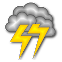 Current Great Lakes Lightning Map From Blitzortung
Michigan Lightning
Local Lightning
Current Great Lakes Lightning Map From Blitzortung
Michigan Lightning
Local Lightning
Smokey Says Today's Fire Danger is
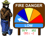
Note that since this station is close to Lake Huron, temperatures can be lower and humidities can be higher than further inland. Fire conditions can vary greatly even a few miles away.
Fire Danger Map
High Moisture Limitations:
With PM2.5 sensors, fog reflects the light, and can result in a higher reading. This is
characteristic to the inherent sensor design.
The condition occurs during rainy or foggy weather, where:
Outdoor Temperature - Dew point Temperature ≤ 2 ℃ 3.6 ℉
Ambient Weather PM25 Air Quality Monitor here at Station Location
Convert to AQI
We are hosting a lightning sensor for TOA Systems.