Select NOAA-NWS Forecast Office Text Products

(Product availability varies with seasons, forecast office, and weather.)

Local Storm Report for Gaylord, MI

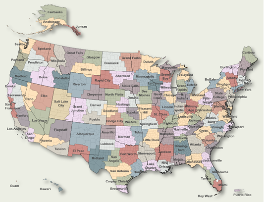
To Select Another NWS Office Click on Map or Choose from List

County Warning Area MAP
Select Forecast Office:   Select Product:  
547
NWUS53 KAPX 301325
LSRAPX

Preliminary Local Storm Report
National Weather Service Gaylord MI
925 AM EDT Wed Apr 30 2025

..TIME...   ...EVENT...      ...CITY LOCATION...     ...LAT.LON...
..DATE...   ....MAG....      ..COUNTY LOCATION..ST.. ...SOURCE....
            ..REMARKS..

0206 PM     Non-Tstm Wnd Gst 3 SSE East Tawas        44.25N 83.46W
04/29/2025  M55 MPH          Iosco              MI   Mesonet

            Mesonet station XTAW Tawas Point.

0214 PM     Non-Tstm Wnd Gst 1 N Dafter              46.37N 84.43W
04/29/2025  M55 MPH          Chippewa           MI   Mesonet

            Mesonet station MC041 Dafter T26.

1155 AM     Non-Tstm Wnd Gst 6 S Cathro              45.07N 83.57W
04/29/2025  M54 MPH          Alpena             MI   ASOS

            ASOS station KAPN Alpena - Phelps Collins
            Field.

1246 PM     Non-Tstm Wnd Gst 1 SSE Barton City       44.66N 83.59W
04/29/2025  M53 MPH          Alcona             MI   Mesonet

            Mesonet station BCYM4 Barton City.

0143 PM     Non-Tstm Wnd Gst 1 S Sault Ste. Marie    46.47N 84.37W
04/29/2025  M53 MPH          Chippewa           MI   AWOS

            AWOS station KANJ Sault Ste Marie -
            Municipal Airport.

0240 PM     Non-Tstm Wnd Gst 3 SE East Tawas         44.25N 83.45W
04/29/2025  M51 MPH          Iosco              MI   Mesonet

            Mesonet station TAWM4 2 SE East Tawas.

0306 PM     Non-Tstm Wnd Gst 3 NNW Munuscong         46.28N 84.21W
04/29/2025  M51 MPH          LSZ322             MI   Buoy

            Buoy station WNEM4 West Neebish Island, MI.

0422 PM     Non-Tstm Wnd Gst 1 ESE Au Sable          44.41N 83.32W
04/29/2025  M50 MPH          LHZ349             MI   Mesonet

            Mesonet station XOSC Oscoda Light.

1201 PM     Non-Tstm Wnd Gst 1 WNW Pellston          45.57N 84.80W
04/29/2025  M49 MPH          Emmet              MI   ASOS

            ASOS station KPLN Pellston - Rgnl Airport Of
            Emmet County.

0107 PM     Non-Tstm Wnd Gst 1 SW Wurtsmith Airfield 44.45N 83.40W
04/29/2025  M49 MPH          Iosco              MI   AWOS

            AWOS station KOSC Oscoda - Wurtsmith AFB.

0342 PM     Non-Tstm Wnd Gst 3 E Sault Ste. Marie    46.49N 84.30W
04/29/2025  M49 MPH          Chippewa           MI   Buoy

            Buoy station LTRM4 Little Rapids, MI.

0240 PM     Non-Tstm Wnd Gst 1 SE Alpena             45.06N 83.42W
04/29/2025  M49 MPH          LHZ348             MI   Mesonet

            Mesonet station APNM4 1 SE Alpena.

1057 AM     Non-Tstm Wnd Gst 2 NNW Grayling          44.68N 84.73W
04/29/2025  M48 MPH          Crawford           MI   AWOS

            AWOS station KGOV Grayling - Army Airfield.

1257 PM     Non-Tstm Wnd Gst 1 SSW Charlevoix        45.30N 85.27W
04/29/2025  M48 MPH          Charlevoix         MI   AWOS

            AWOS station KCVX Charlevoix - Municipal
            Arpt.

0142 PM     Non-Tstm Wnd Gst Rogers City             45.42N 83.81W
04/29/2025  M48 MPH          Presque Isle       MI   Mesonet

            Mesonet station CW4114 Rogers City.

0354 PM     Non-Tstm Wnd Gst 1 NNW Sault Ste. Marie  46.50N 84.37W
04/29/2025  M48 MPH          Chippewa           MI   Buoy

            Buoy station SWPM4 S.W. Pier, MI.

1153 AM     Non-Tstm Wnd Gst 1 NNE Leland            45.02N 85.76W
04/29/2025  M48 MPH          LMZ344             MI   Mesonet

            Mesonet station XLEL Leland Harbor.

1110 AM     Non-Tstm Wnd Gst 4 W Bates               44.76N 85.52W
04/29/2025  M47 MPH          Grand Traverse     MI   Mesonet

            Mesonet station MC112 Mdot Site.

1240 PM     Non-Tstm Wnd Gst 2 NNE Otsego Lake State 44.96N 84.67W
04/29/2025  M47 MPH          Otsego             MI   Mesonet

            Mesonet station MC062 I75nsmm2765-Bdws.

0237 PM     Non-Tstm Wnd Gst 1 ESE Roscommon County  44.35N 84.67W
04/29/2025  M47 MPH          Roscommon          MI   ASOS

            ASOS station KHTL Houghton Lake - Roscommon
            County Airport.

0355 PM     Non-Tstm Wnd Gst 3 SE West Branch        44.25N 84.18W
04/29/2025  M47 MPH          Ogemaw             MI   AWOS

            AWOS station KY31 West Branch.

1133 AM     Non-Tstm Wnd Gst 2 SE Traverse City      44.73N 85.57W
04/29/2025  M46 MPH          Grand Traverse     MI   ASOS

            ASOS station KTVC Traverse City - Cherry
            Capital Airport.

1206 PM     Non-Tstm Wnd Gst Mackinaw City           45.78N 84.73W
04/29/2025  M46 MPH          Cheboygan          MI   Buoy

            Buoy station MACM4 Mackinaw City, MI.

1213 PM     Non-Tstm Wnd Gst 1 SSE Petoskey          45.36N 84.95W
04/29/2025  M46 MPH          Emmet              MI   Mesonet

            Mesonet station AS614 Petoskey.

1232 PM     Non-Tstm Wnd Gst 1 N Mio                 44.68N 84.13W
04/29/2025  M46 MPH          Oscoda             MI   Mesonet

            Mesonet station MMOM4 Mio.

1100 AM     Non-Tstm Wnd Gst 1 SE Greilickville      44.79N 85.63W
04/29/2025  M46 MPH          LMZ323             MI   Mesonet

            Mesonet station XELM Elmwood Township
            Marina.

1140 AM     Non-Tstm Wnd Gst 7 NNE Northport         45.21N 85.55W
04/29/2025  M46 MPH          LMZ344             MI   Mesonet

            Mesonet station GTLM4 6 NE Northport.

1112 AM     Non-Tstm Wnd Gst 1 W Beaver Island       45.70N 85.57W
04/29/2025  M45 MPH          Charlevoix         MI   AWOS

            AWOS station KSJX Beaver Island.

0200 PM     Non-Tstm Wnd Gst 2 WNW Metz              45.30N 83.85W
04/29/2025  M45 MPH          Presque Isle       MI   Mesonet

            Mesonet station MIHAW 2.1 NW Metz (MAWN).

0231 PM     Non-Tstm Wnd Gst 4 S Sid Town            44.38N 83.60W
04/29/2025  M45 MPH          Iosco              MI   Mesonet

            Mesonet station SCKM4 Silver Creek.

1255 PM     Non-Tstm Wnd Gst 1 SSW Rogers City       45.40N 83.82W
04/29/2025  M44 MPH          Presque Isle       MI   AWOS

            AWOS station KPZQ Rogers City - Presque Isle
            County Arpt.

0335 PM     Non-Tstm Wnd Gst 2 WNW Cheboygan         45.65N 84.52W
04/29/2025  M44 MPH          Cheboygan          MI   AWOS

            AWOS station KSLH Cheboygan - Cheboygan
            County Arpt.

0348 PM     Non-Tstm Wnd Gst 4 NNW Bay Mills         46.48N 84.63W
04/29/2025  M44 MPH          Chippewa           MI   Buoy

            Buoy station PTIM4 Point Iroquois, MI.

0100 PM     Non-Tstm Wnd Gst 11 ESE Goetzville       45.99N 83.90W
04/29/2025  M44 MPH          LSZ322             MI   Buoy

            Buoy station DTLM4 De Tour Village, MI.

1205 PM     Non-Tstm Wnd Gst 1 S Mackinac Island     45.85N 84.63W
04/29/2025  M44 MPH          LHZ345             MI   AWOS

            AWOS station KMCD Mackinac Island.

0100 PM     Non-Tstm Wnd Gst 4 SSW Petoskey          45.33N 84.99W
04/29/2025  M43 MPH          Emmet              MI   Mesonet

            Mesonet station MIPKY 3.6 SW Petoskey
            (MAWN).

0143 PM     Non-Tstm Wnd Gst 1 SSE Kinross           46.25N 84.47W
04/29/2025  M43 MPH          Chippewa           MI   AWOS

            AWOS station KCIU Kinross - Chippewa County
            International Arpt.

0236 PM     Non-Tstm Wnd Gst 1 SSE Alpena            45.06N 83.43W
04/29/2025  M43 MPH          Alpena             MI   Buoy

            Buoy station LPNM4 Alpena, MI.

0300 PM     Non-Tstm Wnd Gst 4 W Vogel Center        44.19N 85.13W
04/29/2025  M43 MPH          Missaukee          MI   Mesonet

            Mesonet station MIMCB 3.7 W Vogel Center
            (MAWN).

1200 PM     Non-Tstm Wnd Gst 1 NE Bingham            44.88N 85.68W
04/29/2025  M42 MPH          Leelanau           MI   Mesonet

            Mesonet station MINWM 0.8 NE Bingham (MAWN).

0408 PM     Non-Tstm Wnd Gst 1 E Clear Lake State Pa 45.15N 84.19W
04/29/2025  M42 MPH          Montmorency        MI   Mesonet

            Mesonet station ATAM4 Atlanta.

1122 AM     Non-Tstm Wnd Gst 1 N Cadillac            44.27N 85.42W
04/29/2025  M41 MPH          Wexford            MI   AWOS

            AWOS station KCAD Cadillac - Wexford Count
            Arpt.

1136 AM     Non-Tstm Wnd Gst 1 S Suttons Bay         44.96N 85.65W
04/29/2025  M41 MPH          Leelanau           MI   Mesonet

            Mesonet station FW9533 Suttons Bay.

0117 PM     Non-Tstm Wnd Gst 5 SSW P H Hoeft State P 45.40N 83.92W
04/29/2025  M41 MPH          Presque Isle       MI   Mesonet

            Mesonet station AV695 Rogers City.

1145 AM     Non-Tstm Wnd Gst 2 NE Luzerne            44.64N 84.24W
04/29/2025  M40 MPH          Oscoda             MI   Mesonet

            Mesonet station FW1723 Luzerne.

0130 PM     Non-Tstm Wnd Gst 12 ESE Alpena           45.03N 83.19W
04/29/2025  M40 MPH          Alpena             MI   Mesonet

            Mesonet station TBIM4 12 E Alpena.

0140 PM     Non-Tstm Wnd Gst 1 NE Whitefish Point    46.76N 84.97W
04/29/2025  M40 MPH          Chippewa           MI   Mesonet

            Mesonet station WFPM4 Whitefish Point.

0220 PM     Non-Tstm Wnd Gst 2 SW Alpena             45.05N 83.47W
04/29/2025  M40 MPH          Alpena             MI   Mesonet

            Mesonet station GW0478 Alpena.

1145 AM     Non-Tstm Wnd Gst 1 SSE Indian River      45.40N 84.61W
04/29/2025  M39 MPH          Cheboygan          MI   Mesonet

            Mesonet station DVI03746 Indian River.

0255 PM     Non-Tstm Wnd Gst 1 N Cedarville          46.00N 84.36W
04/29/2025  M39 MPH          Mackinac           MI   Mesonet

            Mesonet station MC072 M-134-W At Cedarville
            - La 16.9.


&&

$$

Previous Local Storm Reports may be found at
NWS Gaylord, MI (APX) Office Local Storm Reports.
(Click 'Previous Version' there to view past versions successively.
Some may differ only in time posted.)

San Juan, PRHonolulu, HI Lake Charles, LA Pueblo, CO Corpus Christi, TX St. Louis, MO Reno, NV Raleigh, NC  Newport/Morehead City, NC Dodge City, KS Houston/Galveston, TX San Joaquin Valley/Hanford, CA Louisville, KY Fort Worth, TX Pittsburgh, PA Austin/San Antonio, TX Sacramento, CA Jackson, MS Phoenix, AZ Northern Indiana, IN Flagstaff, AZ Tallahassee, FL Springfield, MO Riverton, WY Blacksburg, VA Sioux Falls, SD El Paso Area, NM Columbia, SC Wilmington, NC Greenville-Spartanburg, SC Eureka, CA Midland/Odessa, TX Tucson, AZ Goodland, KS Huntsville, AL Amarillo, TX Norman, OK Lubbock, TX Marquette, MI Little Rock, AR Pendleton, OR Missoula, MT Binghamton, NY Boston, MA Green Bay, WI Billings, MT Baltimore/Washington San Diego, CA Tampa Bay, FL Morristown, TN Twin Cities, MN Brownsville, TX Portland, OR Des Moines, IA Memphis, TN Pocatello, ID San Angelo, TX Jacksonville, FL Aberdeen, SD Quad Cities, IA/IL Charleston, SC New Orleans/Baton Rouge, LA Peachtree City, GA Shreveport, LA Grand Rapids, MI Medford, OR Albany, NY Wichita, KS Gray/Portland, ME Spokane, WA Boise, ID Denver/Boulder, CO Great Falls, MT Caribou, ME Key West, FL Miami-South Florida, FL New York City/Upton, NY Melbourne, FL Hastings, NE Paducah, KY Glasgow, MT Bismarck, ND Charleston WV Omaha/Valley, NE Buffalo, NY Jackson, KY Kansas City/Pleasant Hill, MO Gaylord, MI Cheyenne, WY Grand Forks, ND Detroit/Pontiac, MI Central Illinois, IL Burlington, VT Salt Lake City, UT Topeka, KS Nashville, TN Milwaukee/Sullivan, WI Albuquerque, NM Las Vegas, NV Wakefield, VA La Crosse, WI Birmingham, AL Los Angeles/Oxnard, CA Chicago, IL Seattle, WA Rapid City, SD Indianapolis, IN Philadelphia/Mount Holly, PA Mobile/Pensacola State College, PA Cleveland, OH Elko, NV Wilmington, OH Grand Junction, CO North Platte, NE Tulsa, OK San Francisco/Monterey Bay Area, CA Duluth, MN Anchorage, AK Fairbanks, AK Juneau, AK Tiyan, GU

Products Courtesy of NOAA-NWS
NWS Information Parsing Script by Ken True at Saratoga Weather - WFO and Products Scripts by SE Lincoln Weather.
Mapping by Curly at Michiana Weather and by Tom at My Mishawaka Weather.